

Anthurium flexile Schott,
Oesterr. Bot. Z. 8: 180. 1858. TYPE: Costa Rica. Heredia: Pedregel, Wendland 932 (GOET, holotype).
Anthurium myosuroides (H.B.K.) Endl. var. angustifolium Engl., Bot. Jahrb. Syst. 25: 382. 1898. TYPE:Costa Rica. Lim6n: Matina, Piltier 9797 (BR, CR, US).
Scandent epiphyte; the stem elongate; petioles 4-11 cm long, flattened to sulcate adaxially; blade elliptic or narrowly elliptic, (10-) 13-26.5 cm long, (2.5-)3-9(-10.5) cm wide, narrowly subcordate, pliveined at base. Inflorescence usually arching-pendent; peduncle 4÷23 cm long, terete; spathe green, lanceolate, 3.5-9.5 cm long, 0.7-1.8 cm wide; stipe absent or to 2 mm long; spadix 4.5-13 cm long, 0.3-0.5 cm diam. at base; berries orange to red, oblong-ellipsoid to narrowly ellipsoid or narrowly ovoid (with 4 longitudinal ridges on drying), 0.5-1.2 cm long; seeds (1-)2(-3). See Croat (1983: 293) for a more complete description.
The species ranges from Mexico to Panama at 0 to 1,000 m in tropical wet forest life zones.
Anthurium flexile is a member of section Polyphyllium (Croat & Baker, 1978); it is distinguished by its scandent habit, its very slender stem (ca. 3 mm diam.) with tiny roots scattered along the internodes, its thin, more or less elliptic, cordate or subcordate blades, and by its unusually branched growth pattern that consists of sympodial branchlets each bearing one to six leaves above the bicarinate prophyll and terminating in an inflorescence. The lowermost internode of each renewal shoot is adnate to the internode between the penultimate leaf and the last leaf of the preceding shoot. In all other sections of Anthurium each branch of the stem ends with a single leaf and an inflorescence, although the stem branches are commonly so reduced that the branching is usually not apparent.
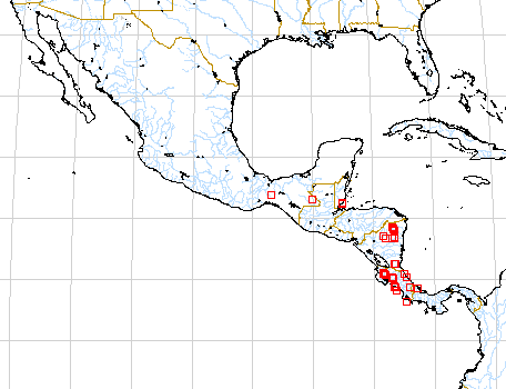
Map of Mesoamerican specimens with coordinates
Belize Belize:, , Gentle 3852 (MICH).
Belize Toledo:, 10 January 1948, Gentle 6359 (LL).
Belize Toledo: Río Blanco,, 20 March 1951, Gentle 7243 (LL).
Belize Toledo: 40 m,, 25 May 1979, Whitefoord 1853 (BM).
Belize Toledo:, 11 June 1981, Whitefoord 3189 (BM).
Belize Toledo: 400 m, 16.27.35N 088.58.52W, 19 May 1997, Gerrit Davidse &
D.L. Holland 36609 (BRH, MO).
Belize Toledo: 420 m, 16.28.25N 088.59.43W, 21 May 1997, Gerrit Davidse &
D.L. Holland 36652 (BRH, MO).
Belize Toledo: 450 m, 16.28.28N 088.57.59W, 27 May 1997, Gerrit Davidse &
D.L. Holland 36843 (IBE, MO, WU).
Costa Rica Alajuela: 350 m, 10.58N 85.20W, 1 April 1988, Gerardo Herrera 1662
(MO).
Costa Rica Guanacaste: 475-500 m, 10.40.30N 85.04.30W, 24 January 1985, Michael
Grayum & Gerardo Herrera 4862 (MO).
Costa Rica Guanacaste: 1000 m,, 17 Feb 1984, Khan et al. 1140A (BM).
Costa Rica Guanacaste: 800-940 m, 10.47N 85.19W, 26 Jan 1986, Michael H. Grayum,
P. Sleeper, A. R. Smith & T. Béliz 6264 (MO).
Costa Rica Guanacaste: 1100 m, 10.55N 85.28W, 15 July 1989, II INBio 194 (MO).
Costa Rica Guanacaste: Parque Nacional Guanacaste, 1060 m, 10.55.45N 85.28.15W,
2 June 1990, Varela et al. 34 (MO).
Costa Rica Guanacaste: 1100 m, 10.23N 84.51W, 23 November 1987, William Haber
& Erick Bello 7823 (MO).
Costa Rica Guanacaste: 1000 m, 10.46.05N 85.17.40W, 17 September 1990, Gerardo
Rivera 602 (MO).
Costa Rica Guanacaste: P.N. Rincón de la Vieja; Cordillera de Guanacaste,
1200 m, 10.47.50N 85.21.10W, 13 January 1993, Dunia Garcia 51 (CR).
Costa Rica Heredia: Finca La Selva, 100 m,, , Wilbur 37197 (DUKE).
Costa Rica Lim—n: 150 m, 09.39N 83.02W, 1 August 1985, Michael H. Grayum, B.
Hammel, L. Bermúdez & R. Acosta 5793 (MO).
Costa Rica Lim—n: 25-40 m, 09.35N 82.39W, 19 Nov 1984, Michael Grayum 4481 (MO).
Costa Rica Lim—n:, 1895, Pittier 9767 (BR). Costa Rica Lim—n: 0 m, 10.27.00N
83.35.00W, 1 December 1990, José Solano 251 (MO).
Costa Rica Puntarenas: 30-40 m, 09.47N 84.37W, 11 January 1985, Michael Grayum
4762 (MO).
Costa Rica Puntarenas: 50 m, 8.27N 83.33W, 11 July 1988, C. Kernan & P.
Phillips 685 (MO).
Costa Rica Puntarenas: Reserva Biológica Carara, 50 m, 09.49N 84.34W,
12 Jan 1990, Zuñiga 84 (MO).
Costa Rica Puntarenas: R.B. Carara, 300 m, 09.14N 84.13W, 8 Dec 1989, Zuñiga
& Jiménez 10 (CR, MO).
Costa Rica Puntarenas: Cordillera de Tilarán, 1100 m, 10.16N 84.47W,
24 September 1991, William Haber & Willow Zuchowski 10884 (CR).
Costa Rica Puntarenas: Cordillera de Tilarán, 1100 m, 10.16.35N 84.47.45W,
10 January 1993, Zobeida Fuentes 111 (CR).
Costa Rica Puntarenas: Cordillera de Tilarán, 1100 m, 10.16.20N 84.49.30W,
20 January 1993, Zobeida Fuentes 144 (CR). C
osta Rica Puntarenas: Valle del Tárcoles, 30-500 m, 09.45.40N 84.36.00W,
8 July 1995, Barry Hammel 19913 (CR).
Costa Rica San José: 400 m, 9.42.24N 84.23.35W, 10 August 1992, J.F. Morales
330 (MO).
Guatemala Alta Verapaz:, 15 May 1964, Contreras 4700 (LL).
Guatemala Alta Verapaz: Río Chiyu,, 5 Oct. 1968, Contreras 7836 (LL).
Guatemala Alta Verapaz:, 1 May 1964, Contreras 4565 (LL).
Guatemala Peten:, 21 Sept. 1966, Contreras 6176 (LL).
Guatemala Peten:, 14 Aug. 1966, Contreras 5971 (LL).
Guatemala Peten:, 20 Aug. 1976, Lundell & Contreras 20254 (LL).
Guatemala Peten:, 13 Oct. 1966, Contreras 6415 (LL).
Honduras Atlántida: 800 ft,, , Yuncker 4615 (MICH). H
onduras Gracias a Dios: Río Platano Biosphere Reserve,, 23 May 1985,
Knees 2742 (BM).
Honduras Olancho: Río Catacamas,, 25 Feb 1982, Blackmore & Heath
1925 (BM).
Mexico Chiapas: Mpo. Pichucalco,, , Gilly & Hernandez 169 (MICH). Mexico
Chiapas:, , Matuda 3644 (MICH).
Mexico Chiapas: 290 m, 16.55N 91.05W, 11 Oct 1986, B. Hammel, E. Martínez &
M. Merello 15671 (MO).
Mexico Oaxaca: 90-110 m, 17.04N 94.45W, 19 Jan. 1987, Thomas B. Croat &
Dylan P. Hannon 63274 (MO).
Mexico Tabasco: Mpo. Teapa,, , Gilly & Hernandez 277 (MICH). Mexico Tabasco:
Mpo. Teapa,, , Gilly & Hernandez 289 (MICH). Mexico Veracruz: 350 m,, 15
Feb. 1990, Hodel & Castillo 1186 (MO).
Nicaragua Jinotega: 200 m, 13.59N 085.19W, 18 febrero 1998, Ricardo Rueda &
Indiana Coronado 7854 (MO).
Nicaragua Río San Juan: Municipio San Juan del Norte, 10.46N 83.46W, 8 Julio
1995, Ricardo Rueda, Blas Hernández y Edith Palma 2667 (MO).
Nicaragua Zelaya: Cerro Baka, 200-320 m, 13.40N 84.30W, 18 Mar. 1979, Pipoly,
J. 4871 (MO).
Nicaragua Zelaya: Santa Rosa,, 06 Sept. 1982, Ortiz, F. 68 .
Nicaragua Zelaya: 11.34N 84.28W, 16 Febrero 1994, Ricardo Rueda, Blas Hernández,
Indiana Coronado y Francisco Collantes 3117 (MO, WU).
Nicaragua Zelaya: 11.31N 84.19W, 24 Febrero 1994, Ricardo Rueda, Blas Hernández
e Indiana Coronado 3415 (MO).
Nicaragua Zelaya: 11.31N 84.19W, 24 Febrero 1994, Ricardo Rueda, Blas Hernández
e Indiana Coronado 3541 (MO).
Nicaragua Zelaya: 200 m, 14.14N 084.31W, 19 Enero 1996, Ricardo Rueda, Alfredo
Grijalva, Rolando Dolmus, Milton Castrillo, Jairo Wong 3934 .
Nicaragua Zelaya: 450 m, 13.43N 085.01W, 14 Abril 1996, Ricardo Rueda, Alfredo
Grijalva, Rolando Dolmus, Milton Castrillo y Norlan Tercero 4246 .
Nicaragua Zelaya: 450 m, 13.43N 085.01W, 14 Abril 1996, Ricardo Rueda, Alfredo
Grijalva, Rolando Dolmus, Milton Castrillo y Norlan Tercero 4280 .
Nicaragua Zelaya: 100 m, 14.22.30N 084.37W, 2 Octubre 1996, A. Grijalva, R.
Rueda, R. Dolmus & M. Castrillo 6036 .
Nicaragua Zelaya: 130 - 562 m, 14.22N 084.36W, 2 Octubre 1996, Ricardo Rueda,
Alfredo Grijalva, Rolando Dolmus y Milton Castrillo 4996 .
Nicaragua Zelaya: 130 - 562 m, 14.22N 084.36W, 2 Octubre 1996, Ricardo Rueda,
Alfredo Grijalva, Rolando Dolmus y Milton Castrillo 5012 .
Nicaragua Zelaya: 700 - 880 m, 14.06N 084.31W, 2 Junio 1997, Ricardo Rueda &
Indiana Coronado 6494 (MO).
Nicaragua Zelaya: 90-110 m, 13.41N 84.50W 13.42N 84.51W, 15 March 1978, W.D.
Stevens 7252 (MO).
Nicaragua Zelaya: 200 - 350 m, 13.48N 084.24W, 10 julio 1997, Ricardo Rueda
& Indiana Coronado 6616 (MO).
Nicaragua Zelaya: 350 - 100 m, 14.36N 084.46W, 28 noviembre 1997, Ricardo Rueda
& Indiana Coronada 7733 (MO).
Panama Darien: 15 m,, 17 Mar. 1937, Allen, P. 290 (MO).