


Anthurium pittieri Engl.,
Bot. Jahrb. Syst. 25: 372. 1898.
Anthurium pittieri. var. pittieri. TYPE: Costa Rica. Heredia: Rancho
Flores, Volcán Barba, 2,505 m, Pittier & Durand865 (BR, hololectotype,
designated Croat & Baker, 1979).
Epiphyte, sometimes somewhat scandent; stems less than 30 cm long; internodes short, 1-1.5 cm diam., leaf scars conspicuous; roots few, descending; cataphylls subcoriaceous, (3)8-12.5(14) cm long, apiculate at apex, drying dark tan, persisting intact, ultimately deciduous.
LEAVES spreading; petioles 3-15 cm long, 4-7 mm diam., subterete, usually bluntly sulcate to weakly flattened; geniculum 2-3 cm long; blades narrowly lanceolate to lanceolate-elliptic to ovate-elliptic or oblong, moderately thick, (8.5)10-43 cm long, 1.5-9 cm wide, acuminate at apex, acute to obtuse or rarely rounded at base; upper surface matte to semiglossy, lower surface semiglossy; midrib broad and convexly raised above and below, diminished and sunken at apex above; primary lateral veins 17-20 per side, ± obscure above, prominulous to flat and ± obscure below, departing midrib at ca. 50° angle, straight to collective vein; collective vein arising near the base, weakly sunken above and prominulous below, 3-6 mm from margin.
INFLORESCENCE ± erect, usually shorter than leaves; peduncle (5)11-14 cm long; spathe green, subcoriaceous, oblong-lanceolate, (3)7-15 cm long, 1.2-2.5 cm wide, caudate-acuminate at apex, decurrent onto peduncle 1-1.5 cm, acute to attenuate at base, inserted at 80° angle on peduncle; spadix green (B & K Yellow-green 5/7.5), (2.2)11-14.5 cm long, (3)7-8 mm diam. at base, (2)4-5 mm diam. at apex; flowers rhombic, 6-6.3 mm in both directions, the sides straight to weakly sigmoid; 2-3 flowers visible in the principal spiral, 3-5 flowers visible in the alternate spiral; tepals matte, minutely papillate, larger plants with tepals usually mounded giving spadix a knobby appearance, lateral tepals ca. 5 mm wide, the inner margin straight; pistils usually exserted, green, matte; stigma elliptic, ca. 0.6 mm long, brushlike, exserted and glistening with a small droplet for 3 or 4 days ca. 2-3 weeks before anthers emerge, dry and black as stamens emerge; stamens emerging slowly in scattered manner throughout spadix, exserted on minute, green filaments that retract holding anthers at sides of pistil; anthers cream-colored ca. 0.5 mm long, ca. 1 mm wide; thecae tan, ellipsoid, not divaricate; pollen pale yellow fading to white, soon dispersing.
INFRUCTESCENCE pendent; spadix 5-15 cm long; berries yellow to orange
in Panama or reportedly white in Costa Rica, obovoid, acute at apex, 1-1.5 cm
long, 7 mm wide; seeds 2, green, flattened. Figs. 136 and 137.
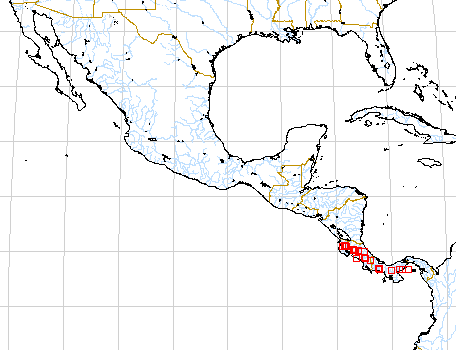
The species is known from Costa Rica and Panama at 50 to 2,100 m elevation
in tropical wet and premontane rain forest life zones. A specimen recently collected
by Emesto Ancuash (1230) under the auspices of Brent Berlin's anthropological
studies in Peru (Dept. of Amazonas, Río Cenepa) is apparently also this species.
It would be the first collection of the species from South America.
Anthurium pittieri is a member of section Oxycarpium and
is distinguished by its coriaceous, epunctale leaf blades, premature emergent
berries, and especially by the long-decurrent spathe.
The species is variable in leaf blade shape and in the degree of emergence of
the pistils. Smaller plants tend to have the tepals flat with the pistils not
noticeably emergent while larger plants have the pistils somewhat protrudent
with the lepals turned somewhat upward. Specimens with unusual leaf shape include
António 2139 from Panama with oblong leaves, 6.5 times longer than wide
and Croat 35295 from Dominical (Puntarenas, Costa Rica) with leaves almost
as wide as long.
It is most easily confused with A.
interruptum and A. carnosum,
both of which differ in usually having more elongate internodes, in lacking
a conspicuously decurrent spathe, and in having either green or reddish berries.
Anthurium pittieri is reportedly related to A. decurrens Poepp.
from
Amazonian Peru but differs from that species in having a much shorter stipe.
 |
 |
Map of Mesoamerican specimens with coordinates
Costa Rica : 1550-1600 m, 10.18N 84.47W, 19 Aug 1984, Michael H. Grayum
& Pam Sleeper 3844 (MO).
Costa Rica : 1400 m, 10.20N 84.50W, 16 Sep 1986, William A. Haber ex Eric Bello
C. 5631 (MO).
Costa Rica : Cerro Amigos, 1700 m, 10.19.5N 84.47.35W, 6 Aug 1988, Hayworth
301 (WIS).
Costa Rica Alajuela: 1400-1500 m, 10.17N 84.45.30W, 27 June 1991, Bello & Cruz
2829 (MO, CR).
Costa Rica Alajuela: W 800-1000 m, 10.12.53N 84.36.28W, 3 noviembre 1986, Gerardo
Herrera Ch. & Victor Mora 210 (MO).
Costa Rica Alajuela: R.B. Monteverde; Cordillera de Tilar‡n, 1600-1700 m, 10.18.30N
84.47.00W, 15 November 1991, Erick Bello 4261 (CR).
Costa Rica Cartago: 1350 m, 09.47N 83.48W, 6 Aug 1984, Michael H. Grayum & Pam
Sleeper 3689 (MO).
Costa Rica Cartago: 1650 m, 09.42N 83.47W, 11 Aug 1984, Michael H. Grayum, Brian
Jacobs & Pam Sleeper 3767 (MO).
Costa Rica Guanacaste: Parque Nacional Guanacaste, 1100 m, 10.55.50N 85.28.10W,
27 February 1989, Isidro Chac—n 2437 (CR, MO).
Costa Rica Guanacaste: 1200 m, 10.48N 85.19W, 8 August 1987, Gerardo Herrera
654 (MO).